3D Concrete Scanning
United Scanning’s use of Ground Penetrating Radar technology is called upon by Western Australia’s largest and most sophisticated companies to assist answering challenging questions that get asked during construction projects. Utilising state of the art equipment our technicians pinpoint services deep underground and cables and lines buried far below the surface inside concrete. .

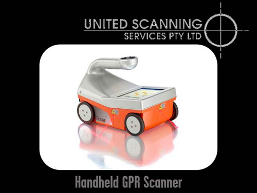
Figure 1: GSSI 3D Ground Penetrating Scanners as used by United Scanning
Our clients commonly wish to answer questions that are independent of one another. Questions like, “What is the size of the reinforcement in this slab?” and, “How much cover is there over this reinforcement?” can be answered one after another and the answer to one question is not necessarily related to the answer to another.
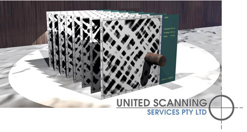
Sometimes however, our clients wish to see the relationship of buried features to one another. Perhaps they wish to be able to visualise where the post-tensioned cables run relative to the reinforcing mesh. Or the question being answered might be involve understanding the position and orientation of a particular identified defect inside concrete. Finding a place to position a penetration point through concrete that has multiple layers of reinforcing mesh can be a challenge without a 3D representation that shows each of the layers of reinforcing mesh in relationship to one another.

Figure 2: Multiple profiles to find penetration points
At times like this, a single profile views that shows a cross section of the concrete or subsurface is not sufficient. Even 5 or 10 cross sections may only answer the question imperfectly. And when a huge surface like a road is being scanned, individual profiles fail to meet the common requirements. This is when the ability to provide our clients with 3D imagery of the interior of the concrete or the subsurface being inspected is highly valued.
United Scanning’s experienced technicians have been trained in the use of Ground Penetrating Radar to obtain data that can be processed into 3D volumes and have applied this training for a large number of clients. When acquiring this data a higher degree of precision is required on the part of the technician and the scanning can be little time intensive to complete.
The generation of a high quality 3D volume to provide clear subsurface visualisation is based on the acquisition of multiple cross sections or profiles that can be stitched together by the software and then the gaps between them is interpolated using the existing data. Each profile that is acquired should be equidistant from the previous profile, with the distance between them being a function of the quality of the 3D volume that is required. Two sets of profiles are taken, perpendicular to one another and covering the same area.
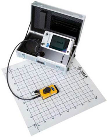
In order to ensure that each profile is acquired at the correct distance to its predecessor and is acquired straight, the United Scanning technician will either bring a printed scanning guide or rule out a scanning guide on site. A scanning guide can be a paper or plastic template with a lined grid printed on it. As the paper or plastic is transparent to the Ground Penetrating Radar, the technician can scan over this guide, following the printed grid to acquire appropriately placed profiles of the required length. Should the shape of the area being scanned be less regular or the surface being scanned be rougher than the printed scanning guide will allow, the technician will rule up a custom grid on site.

Figure 3: 3D scanner and scanning guide
Once all of the profiles have been acquired and saved within the memory of the scanner, the data is transferred off the device memory card and imported into United Scanning’s Ground Penetrating Radar data post processing software. This software will be used to perform a number of enhancements on each of the profiles. Each profile will corrected for time zero, adjusting the imagery to compensate for variations in the local temperature, concrete or soil density and air gap between antennas and surface. The background noise will reduced as far as practical, reducing clutter and static. If necessary the gain will be altered to make the relevant areas of the scan easier to interpret and the color schema modified to better show the important information. Each profile will be migrated, altering the imagery so that instead of showing hyperbolas where features are found, they show the most accurate outline of the feature available in the scanning conditions on site.

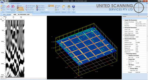
Figure 4: 3D volume showing reinforcing mesh
Finally, all of the individual profiles are stitched by the software into one single volume. The scanned area will not be presented as a rotatable 3D block or volume with the discovered features clearly visible within the volume. By rotating the volume and using software tools that allow us to capture 2D profiles out of the 3D volume at any point within the volume, United Scanning can answer much more challenging questions. The volume can be “sliced and diced” however the client requires, providing visibility into areas otherwise impossible to visualise.
Hire United Scanning to perform a high resolution 3D scan for your next project or call us today for a free demonstration of our capabilities.
